|
Cemetery
Reading
| ||||||||||||||||||||||||||
| Cemetery Name: |
Williams |
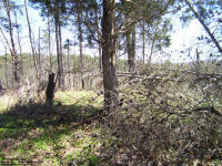
Click on the photos above to enlarge |
| County: | Mason | |
| USGS Quad: | Robertsburg Map | |
| Coordinates: | 38.7109ºN -81.9057ºW | |
| Maintained by: | not maintained | |
| Land owner: | Eblin family | |
| Date added to WVCPA register: | April 2009 | |
| Condition of cemetery**: | Abandoned (April 2009) | |
| Accessibility: | The cemetery is located on Calispel Ridge on the old Milton Sayre farm, on a high knoll directly west of the old Williams homestead (see map for exact location) - very difficult access, and then only on foot. Easiest route is from the east side of Calispel Ridge. | |
|
** Condition of cemetery as
observed on the given date - |
||
| Comments:
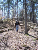
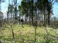
Above: Joel & our guide, Dennis Little, on the climb up the hill behind the ruins of the Williams' cabin |
Dates in Red
above are not inscribed on the tombstone and have either been calculated based
on death date or are as a result of research on the individual. John and Celia Williams were the parents of eleven known children, others of whom may be buried in the unmarked graves in this cemetery. John Williams is recorded as being one of the founding members of Wolfe Valley Baptist Church, located east of Calispel Ridge near the junction of Poplar Fork and Thirteen Mile Creek on Tribble Road. The cemetery is located on a high, flat knoll with sweeping views through the trees of Calispel Ridge. When WVCPA founders Joel and Donna Duprey visited the cemetery on Easter Sunday in 2009, despite many trees and branches that had fallen across the cemetery and the trail up to it, it was still relatively clear of undergrowth and covered in a beautiful blanket of Forget-me-nots that had spread well outside of the old cemetery's fence line. |
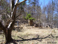
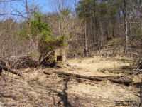
Above: The ruins of the Williams' cabin - note the tremendous size of the hearth stones in the top photo when compared to Joel & Dennis who are both about 6' tall. |
Updated: 07 September 2012
