|
Cemetery
Reading
| ||||||||||||||||||||||||||||||||||||||||||||
| Cemetery Name: |
Dunn Family |
Click on photo to enlarge |
| County: | Mason | |
| USGS Quad: | Cheshire Map | |
| Coordinates: | near 38.6369ºN -82.0003ºW | |
| Maintained by: | Dunn family | |
| Land owner: | Unknown | |
| Date added to WVCPA register: | June 2006 | |
| Condition of cemetery**: | Poor (June 2006) | |
| Accessibility: |
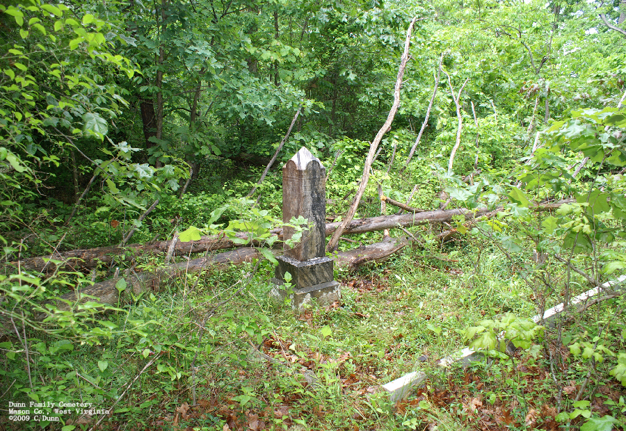
This cemetery is located out Dunlavy Ridge about 2 miles past Mt. Union Methodist Church on or near the Mason/Putnam Co. line on the old Dunn family farm in Clendenin District - so close to the Putnam County line that it may actually be in Putnam County. Accessibility conditions are poor. |
|
|
may not be representative of care at other times of the year Scale: Excellent - Good - Fair - Poor - Abandoned |
||
| Last Name: | First Name: | Born: | Died: | Inscription: | Photo: | Source: |
| Dunn | William | 4 August 1817 | 10 August 1900 | [Husband
and wife - shared stone] "Wife of Wm. Dunn" "Thy Will Be Done" |
|
|
| Dunn | Martha A. | 31 October 1818 | 4 August 1900 |
|
| Comments:
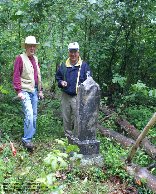
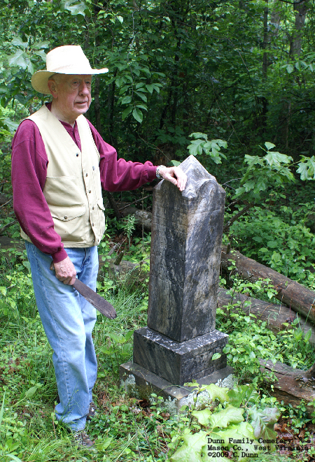
Bertram Foglesong Dunn (on left above) and Joe Dunn (on right) from a recent clean-up visit to the cemetery with Bertram's son Chris Dunn, contributor of the photos and information for this cemetery page.
|
Dates in Red are not inscribed on the tombstone and have either been calculated based on death date or are as a result of research on the individual. A note with directions from WVCPA volunteer, Chris Dunn: "To get to this cemetery, starting from the corner of Mt. Vernon & Camden in Pt. Pleasant, take Viand / Hwy. 2 South through downtown Pt. Pleasant, cross the Shadle Bridge (over the Kanawha River), and take 35 South toward Charleston. At about 21.8 miles you will make a right turn up a road (name unknown). As of this time there is an Exxon Station on the corner of this road and 35 South. Follow this road. At about 23.9 miles Mt. Union Methodist Church will be on your left. At 24 miles, make a right. This is the first right past the church. Follow this road. You will pass several homes etc. The road winds back and forth quite a bit. At 25.6 miles there is a dirt road which comes in at the right. Stop here. You are in the right place if in the meadow of the right side of the dirt road there is a little pond, or the remnants of what could be a pond. The cemetery site is about 750 paces down the road (one pace was counted each time a foot hit the ground). At about 590 to 600 paces you will come upon a gate. This is the closest "landmark" to the graves. At about 750 paces there should be on your right some "steps", and a movable barbed wire gate held in place by a yellow rope, and a white nylon rope (on the back of one of the 2x4's is carved 'Dunn'). Just loosen these, and proceed straight ahead, the graves are visible almost immediately." |
![]()
![]()
![]()
![]()
![]()
![]()
![]()
![]()
![]()
![]()
![]()
![]()
![]()
![]()
Updated: 07 September 2012