WestVirginiaCemeteryPreservationAssociation

Cemetery Reading

Cemetery Name:

Pantell Cemetery

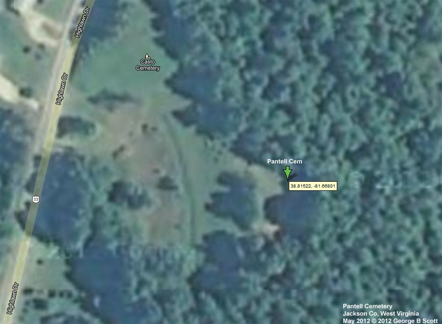
Pantell Cem

County: Jackson
USGS Quad: Ripley        Map
Coordinates: 38.8152ºN  -81.6680ºW
Maintained by: unknown
Land owner unknown
Date last visited May 2012
Condition of cemetery**: Abandoned
Accessibility: By Route 33 east of Ripley. Could not locate cemetery at GPS location. Found large cedar tree with rectangular slab which was unreadable next to cedar tree. Searched for several hundred feet in general vicinty and found no other evidence of gravestones. The slab was definitely man made.

** Condition of cemetery as observed on the given date -
may not be representative of care at other times of the year
Scale: Excellent - Good - Fair - Poor - Abandoned


Last Name: First Name:

Born:

Died:

Inscription:

Photo:

Source:

Image2352 unreadable     [Large unreadable slab is directly beneath the name 'Scott' on the photo. This is so weathered that I could not determine if the slab may have fallen face down.] Click here to see tombstone photo From reading by WVCPA or one of its volunteers


Comments: Data in Red is not inscribed on the tombstone and has either been calculated based on death date or as a result of research on the individual.

If you have photos that we may add to this page, of tombstones or portraits of those buried here, or if you have any additions or corrections to the roster of burials listed above, please contact WVCPA at .  


Easy to Access. On Rt 33 east of Ripley. See map.

Pantell Cem  

WVCPA Home Page


Adopted Cemeteries Adopted Churches Cemetery Readings Current Projects Favorite Inscriptions In The News Our Mission Resources Our Vision What Can I Do? What's New? Who Are We? WV Cemeteries


 Updated: 19 April 2013