|
Cemetery Reading
| |||||||||||||||||||||||||
| Cemetery Name: |
Fisher |
|
| County: | Jackson | |
| USGS Quad: | Sissonville Map | |
| Coordinates: | 38.6050ºN -81.6358ºW | |
| Maintained by: | Unknown | |
| Land owner: | Unknown | |
| Date added to WVCPA register: | December 2008 | |
| Condition of cemetery**: | Excellent (December 2008) | |
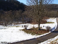
| Accessibility: | The cemetery is located between Kenna and Sissonville, on the left (West) side of Dudden Fork Road (CR 21-38). Directions from Charleston: travel I-77 North to exit 119. Turn left on CR-21, travel CR-21 for approximately 300 feet. Turn right onto Dudden Fork Road (CR-21-38), go approximately 1/2 mile to the junction of Highland Drive (CR 19-2). Remain on Dudden Fork Road (left) for approximately 1/10 mile, the cemetery is located near the road, on the left side. | |
|
** Condition of cemetery as
observed on the given date - |
||
| Comments: |
Dates in Red are not inscribed on the tombstone and have either been calculated based on death date or are as a result of research on the individual. WVCPA thanks volunteers Charlotte and Steve Iman for photographing and documenting this cemetery. |
Updated: 07 September 2012
